A drone’s eye view of the Great Wall
Intel used its tech chops to map out a restoration plan for the landmark.

One of the wonders of the world, the Great Wall of China measures more than 13,000 miles in length, with some sections dating as far back as the 14th century. Over several Chinese dynasties, it has been rebuilt and maintained in various ways in a bid to preserve it as a heritage landmark.
But Intel has seriously raised the bar on the restoration front, using drones and AI to map and create a 3D version of the wall. Working with China’s Wuhan University and the China Foundation for Cultural Heritage Conservation, the tech company used Intel Falcon 8+ drones to collect more than 10,000 hi-res images of the wall, allowing researchers to access the damage and map out a restoration plan.
On top of helping preserve an important landmark, the project is Intel’s latest effort at highlighting the power of its technology. Last year, it launched an arctic drone expedition to survey polar bear populations in light of climate change.
[iframe_youtube video=”dTVEQLjwuL4″]


Random Cool»

This year’s selection of under-the-radar ideas includes better for the planet deodorant and a way to level up your bread making.

Rethink created a pair of briefs for Prostate Cancer Foundation BC that let men get tested without baring it all.

A replica of the titular TV vessel is offering overnight visits to non-crew members for the first time in 22 years of service.

The beer brand has released paint colours to encourage employees to reclaim their own spaces after years of working from home.
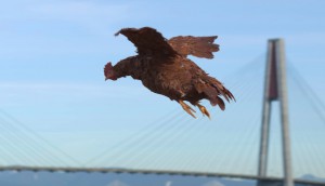
Rethink created an animatronic hen to build hype for Nuggs, a McCain-backed vegan nugget brand.

Leave a Reply